 Trexmount Ventures
Trexmount Ventures
Trexmount Ventures

Popular Searches
Ready to plan your next getaway? Let’s connect and create something incredible together.
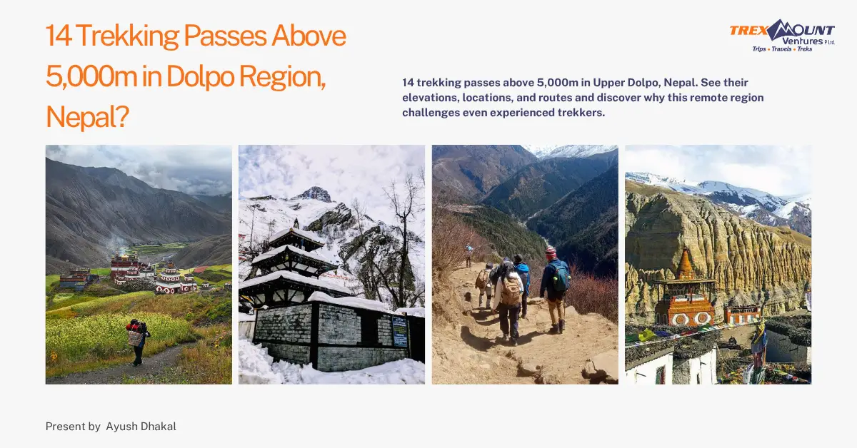

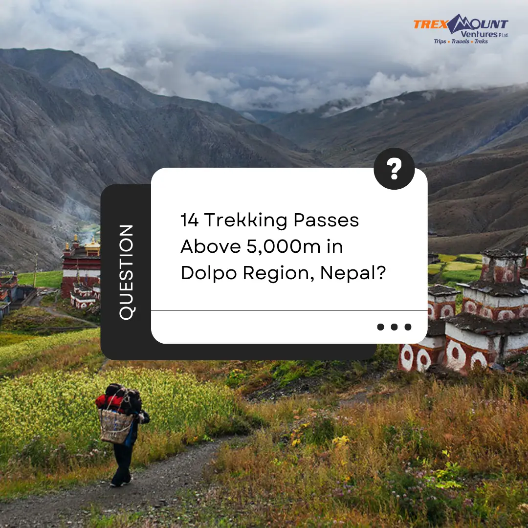
Upper Dolpo is one of Nepal's most remote trekking destinations, but its real attraction goes far beyond isolation. The region is crossed by a network of high Himalayan passes, many of them rising above 5,000 meters and linking valleys, villages, monasteries, and old trans-Himalayan trade routes.
For trekkers, these passes are often the defining challenge of a Dolpo expedition. Unlike the better-known passes of the Everest and Annapurna regions, many Upper Dolpo trekking passes are reached through remote valleys where camping, self-sufficiency, and careful route planning are essential.
A number of published trekking and geographical sources document high passes across Dolpo, including Kang La, Sela La, Jyanta La, Numa La, Chan La, Jhyarko La, Mola La, Niwas La, Jungben La, Nagdalo La, Nyingma Gyanzen La, Yala La, and Chyargo La. The Karnali Province Tourism Master Plan also identifies a group of these passes as Dolpo's high passes.
This guide brings together 14 high-altitude passes reported at or above 5,000 meters in the wider Dolpo trekking area, including their approximate elevations, locations, routes, and difficulty.
Important note: Pass elevations and names can vary between maps, trekking operators, and geographic sources. Some passes in this list are in Upper Dolpo, while others form routes connecting Upper Dolpo with Lower Dolpo, Mugu, Mustang, or adjacent Himalayan valleys. Therefore, the list should be understood as a trekking-focused compilation of high passes associated with the Dolpo region, rather than an official government declaration that exactly 14 passes exist in Upper Dolpo.
Dolpo occupies a vast high-altitude landscape in northwestern Nepal, close to the Tibetan border. Its geography is dominated by deep river valleys, barren plateaus, snow-covered ridges, and mountain chains that make direct travel between settlements difficult.
Historically, people moved through this landscape using high passes rather than modern roads. Several of today's trekking routes follow these older connections.
The terrain also explains why Dolpo trekking feels different from more commercial Himalayan routes. You can spend days away from large settlements, cross passes above 5,000 meters, and camp in valleys where infrastructure is extremely limited.
Recent trekking accounts continue to describe Upper Dolpo as one of Nepal's toughest and most remote trekking destinations. A 2025 Reddit discussion, for example, described a 21-day Upper Dolpo Circuit as one of the toughest and longest treks the contributor had undertaken.
The difficulty is not simply the altitude. It comes from a combination of:
Some Dolpo routes also require camping because established teahouse infrastructure is much less developed than on routes such as Everest Base Camp or the Annapurna Circuit.
Location: Lower Dolpo, near the Danigar and Temche areas
Route: Numa La → Danigar → Baga La → Temche → Phoksundo/Ringmo
Difficulty: Hard
Baga La is one of the best-known high passes in the Dolpo trekking region. It is normally crossed on the classic Lower Dolpo circuit after Numa La.
The route climbs from the Baga La base-camp area through increasingly barren terrain before reaching the pass. From the top, trekkers get broad views across the surrounding mountains and valleys.
The descent can be particularly demanding because sections of the trail involve loose rocks and scree. Visit Himalaya Treks describes the climb as steep and the descent as rough, with the pass reaching 5,169 meters.
Baga La is therefore not simply a high point on the itinerary. It is one of the Lower Dolpo circuit's major physical challenges.
Best suited for: Experienced trekkers with good high-altitude fitness.
Location: Between the Barbung Valley and the Dho Tarap area
Route: Barbung/Chap Chu area → Chan La → Dho Tarap
Difficulty: Very hard
At approximately 5,378 meters, Chan La is one of the highest major passes associated with the Dolpo trekking network.
The pass connects valleys around Dho Tarap with routes farther east and southeast. The climb is steep from sections of the approach, but the pass itself is not necessarily technical in normal conditions.
A Great Himalayan Trail account describes Chan La at 5,378 meters and notes that although the route is high, the gradient at the pass is relatively manageable compared with some other crossings.
At this elevation, however, even a non-technical trail can become extremely demanding because of thin air, cold, snow, and weather.
Best suited for: Experienced high-altitude trekkers.
Location: Dolpo–Mugu borderlands
Route: Takla Khola → Chyargo La → Thaju Chaur/upper valleys
Difficulty: Very hard
Chyargo La is one of the more remote crossings on this list.
The route approaches the pass through remote valleys and high alpine terrain before climbing to approximately 5,150 meters. A detailed account of the Rara-to-Phoksundo crossing describes the approach as rocky and the final climb as a steep rocky slope.
Another trekking route records Chyargo La at 5,150 meters on the route between Takla Khola and Thaju Chaur.
The combination of altitude, remoteness, and limited trail infrastructure makes this considerably more demanding than a standard teahouse trek.
Best suited for: Experienced trekkers comfortable with remote camping routes.
Location: Between Dho Tarap and the Upper Dolpo/Saldang area
Route: Tokyu/Dho Tarap → Jyanta La → Dho Tarap or Saldang direction
Difficulty: Hard to very hard
Jyanta La is another important high crossing within the Dolpo trekking network.
At approximately 5,220 meters, it sits well above the altitude reached on most mainstream Nepal trekking routes. It is associated with routes connecting the Dho Tarap area toward Upper Dolpo.
One published Upper Dolpo itinerary crosses Jyanta La at approximately 5,220 meters while traveling from a high camp toward Tokyu.
The difficulty is largely altitude-related. Trekkers must climb from already high camps, meaning the body has less oxygen available during the ascent.
Best suited for: Experienced trekkers with proper acclimatization.
Location: Between the Dho Tarap and Chharka/Trekker's routes
Route: Dho Tarap/Kharka area → Jhyarko La → Chharka-side valleys
Difficulty: Hard
Jhyarko La is another high crossing documented in Dolpo's network.
Sources differ considerably on the exact elevation. Some references place it around 5,027 meters, while the Karnali Province Tourism Master Plan lists Jhyarko La at a higher figure.
That difference illustrates an important point about Dolpo: elevations published online should not always be treated as absolute survey measurements.
The pass forms part of remote routes around Dho Tarap and the Chharka area and can involve long approaches through sparsely populated terrain.
Best suited for: Experienced trekkers.
Location: Eastern Dolpo, toward the Dolpo–Mustang connection
Route: Chharka Bhot → Jungben La → Mustang/Kagbeni-side routes
Difficulty: Extreme
Jungben La is one of the highest passes associated with the Dolpo trekking network, reaching approximately 5,550 meters.
The pass is particularly important for trekkers attempting routes between Dolpo and Mustang. It rises east of Chharka Bhot and forms part of demanding trans-Himalayan itineraries.
A Great Himalayan Trail account describes Jungben La at 5,550 meters and notes that the approach is long rather than extremely steep. Even so, the elevation makes the crossing challenging.
At more than 5,500 meters, the difference between a difficult trekking day and an unsafe day can depend heavily on weather and acclimatization.
Best suited for: Highly experienced trekkers and expedition-style groups.
Location: Kagmara Himal, western Dolpo
Route: Lasa/Kagmara Valley → Kagmara La → Kangmara Phedi and surrounding valleys
Difficulty: Very hard
Kagmara La belongs to the high mountain landscape around Kagmara Himal.
The pass is listed at approximately 5,115 meters in Great Himalayan Trail pass references.
Unlike the classic Lower Dolpo circuit, routes through Kagmara involve more remote terrain and can require substantial logistical preparation.
The surrounding Kagmara region is characterized by high alpine valleys and dramatic mountain terrain. This makes the pass attractive to trekkers looking for less-traveled routes but also increases the importance of an experienced guide and a properly equipped support team.
Best suited for: Experienced trekkers seeking remote wilderness routes.
Location: Chharka Tangsong, Dolpa
Route: Chharka-side valleys → Mola La → Chharka Bhot/connecting routes
Difficulty: Hard
Mola La, also called Chharla La in some geographic references, rises to approximately 5,030 meters.
OpenStreetMap-based geographic data places Mola La in Chharka Tangsong of Dolpa at 5,030 meters.
The pass appears on routes connecting the Chharka area with surrounding valleys. It is generally considered a demanding high-altitude crossing because trekkers reach it after already spending considerable time at elevation.
The physical difficulty is amplified by Dolpo's remote conditions: there are few easy escape routes, limited infrastructure, and long distances between camps.
Best suited for: Experienced trekkers with good endurance.
Location: Between the Phoksundo/Ringmo area and Shey Gompa
Route: Phoksundo Lake → Nagdalo High Camp → Nagdalo La → Shey Gompa
Difficulty: Very hard
Nagdalo La is one of the signature passes of Upper Dolpo.
The route commonly begins around Phoksundo Lake and climbs through the remote landscape toward a high camp before crossing the pass and descending toward Shey Gompa.
Several Upper Dolpo itineraries place Nagdalo La at approximately 5,350 meters.
A trekking account describes the climb toward Nagdalo La from the northern side of Phoksundo Lake and notes that once trekkers move above 5,000 meters, the ascent becomes a slow, demanding effort.
For many trekkers, this is one of the defining days of an Upper Dolpo expedition.
Best suited for: Experienced high-altitude trekkers.
Location: Eastern Dolpo, between Chharka Bhot and Mustang-side routes
Route: Chharka Bhot → Niwas La → Kagbeni/Mustang direction
Difficulty: Very hard
Niwas La reaches approximately 5,120 meters and forms part of the high route connecting Dolpo toward Mustang.
The pass is frequently paired with Jungben La on longer Dolpo-to-Mustang routes. A Great Himalayan Trail account records both Niwas La at 5,120 meters and Jungben La at 5,550 meters.
Although Niwas La is lower than Jungben La, it should not be considered easy. Trekkers approach it after spending days in remote high-altitude terrain.
Best suited for: Experienced trekkers undertaking extended Dolpo–Mustang routes.
Location: Lower Dolpo, south of Dho Tarap
Route: Dho Tarap → Numa La → Danigar → Baga La
Difficulty: Hard to very hard
Numa La is perhaps the most recognizable high pass of the Lower Dolpo Trek.
At approximately 5,309 meters, it is crossed before Baga La on the classic route toward Phoksundo.
The climb is steep in sections. Visit Himalaya Treks describes a succession of steep climbs before reaching the top of Numa La, followed by a descent toward Danigar.
The pass offers views toward the Dhaulagiri range and surrounding high mountains.
For trekkers following the Lower Dolpo circuit, the combination of Numa La and Baga La makes this section particularly demanding.
Best suited for: Fit and experienced trekkers.
Location: Remote Dolpo–Mugu border region
Route: Pho → Nyigma Gyanzen La → Pung Kharka
Difficulty: Extreme
Nyigma Gyanzen La, also written as Nyingma Gyanzen La or Nyingma Gyaltsen La in different sources, reaches approximately 5,563 meters.
The pass lies in one of the most remote parts of the Dolpo–Mugu landscape.
A Great Himalayan Trail pass reference lists Nyingma Gyanzen La at 5,563 meters and places it between Pho and Pung Kharka.
A long-distance trekking account also describes approaching Nyigma Gyanzen La after crossing Chyargo La and moving through an exceptionally isolated section of upper Mugu.
This is not a pass that should be treated like a standard tourist trekking crossing. The altitude and remoteness make logistics and weather assessment critical.
Best suited for: Highly experienced trekkers and expedition-style groups.
Location: Upper Dolpo, around Shey Gompa and Namgung
Route: Shey Gompa → Sela La → Namgung → Saldang
Difficulty: Hard
Sela La is one of the important high crossings on the Upper Dolpo circuit.
Sources give slightly different names and elevations, including Sela La, Sela Shey Bhanjyang, and Sela Muckchung. Elevations also vary, with published figures around 5,010–5,126 meters.
The route commonly connects Shey Gompa with Namgung and eventually Saldang.
The Karnali Province Tourism Master Plan lists Sela La at approximately 5,095 meters between Saldang and Shey.
The trail is demanding primarily because of altitude and the barren high-mountain terrain rather than technical climbing.
Best suited for: Experienced trekkers with good acclimatization.
Location: Dolpo–Mugu highlands near the Kanjiroba range
Route: Pung Kharka → Yala La → Chyandi Khola
Difficulty: Extreme
Yala La is one of the highest passes in this compilation, reaching approximately 5,414 meters.
It forms part of remote routes between the Pung Kharka and Chyandi Khola areas. Great Himalayan Trail references place it at 5,414 meters, while some expedition accounts use slightly different figures.
The approach can be long and exposed, and weather becomes a serious factor at this altitude.
One detailed trekking account describes waiting for better weather before crossing a roughly 5,450-meter saddle in the Yala La area.
The combination of altitude, remoteness, and uncertain weather makes Yala La one of the more serious crossings associated with the Dolpo region.
Best suited for: Highly experienced trekkers with strong high-altitude preparation.
Not every pass above 5,000 meters has the same difficulty.
Altitude is only one part of the equation. A 5,100-meter pass can sometimes feel more difficult than a higher pass if the approach is steep, the trail is poorly defined, or weather conditions deteriorate.
Among the passes in this list, Jungben La, Nyigma Gyanzen La, Yala La, Chan La, Nagdalo La, and Chyargo La should be treated as particularly demanding because of their combination of elevation and remoteness.
The classic Lower Dolpo pair of Numa La and Baga La is also challenging. The standard Lower Dolpo route specifically highlights the two crossings as major high-altitude sections.
For comparison, a published list of Nepal's high passes places Dolpo crossings such as Nagdalo La, Numa La, Saldang La, Jeng La, and Baga La among Nepal's major passes above 5,000 meters.
This is an important distinction. No, not all 14 should automatically be described as being exclusively inside Upper Dolpo.
Dolpo is a large geographical region containing different trekking areas, and some high passes connect Upper Dolpo with Lower Dolpo, Mugu, Mustang, or other neighboring valleys.
For example:
The Karnali Province Tourism Master Plan itself groups a number of these crossings under Dolpo's high passes, including Kang La, Sela La, Jyanta La, Numa La, Chan La, Jhyarko La, Mola La, Niwas La, Jungben La, Nagdalo La, Nyingma Gyanzen La, Yala La, and Chyargo La.
Therefore, if your article is specifically titled “14 Trekking Passes Above 5,000m in Upper Dolpo, Nepal,” the safest editorial approach is to explain in the introduction that the article covers passes associated with the wider Dolpo trekking network, rather than claiming that every one of them lies strictly inside the administrative or geographical boundaries of Upper Dolpo.
Dolpo is not simply another high-altitude trekking destination.
The region combines high mountain crossings with cultural landscapes shaped by Tibetan Buddhism and Bon traditions. Villages such as Shey, Saldang, Dho Tarap, and Ringmo provide a completely different experience from the crowded trekking corridors of Nepal.
The lack of infrastructure is part of the challenge.
On many routes, trekkers cannot depend on a lodge appearing at the end of every walking day. Camping, food logistics, porters, pack animals, navigation, and weather planning become much more important.
This is one reason experienced trekkers often describe Upper Dolpo as a serious expedition rather than a conventional lodge trek.
A recent Reddit discussion about Upper Dolpo similarly highlighted its remoteness, limited infrastructure, high-altitude environment, and demanding conditions.
For travelers who want solitude, ancient Himalayan culture, dramatic landscapes, and challenging mountain crossings, that difficulty is exactly what makes Dolpo attractive.
Crossing a pass above 5,000 meters should never be judged by elevation alone.
Several factors determine the actual difficulty:
Above 5,000 meters, the air contains substantially less oxygen than at sea level. Even experienced hikers may find normal walking surprisingly exhausting.
Proper acclimatization is essential. Dolpo itineraries should allow gradual elevation gain and appropriate rest days before the highest crossings.
Some routes involve:
Weather can change rapidly at high altitude. Snowfall, wind, clouds, and poor visibility can make a pass considerably harder than expected.
This may be the biggest difference between Dolpo and more commercial trekking areas.
If something goes wrong, you may be many hours or even days from a road, large settlement, or medical facility.
The best trekking seasons generally correspond with periods of more stable weather.
Spring and autumn are generally favored for high-altitude trekking, although specific Dolpo routes can have different seasonal considerations.
The monsoon also behaves differently in the trans-Himalayan rain-shadow areas of Dolpo than it does in Nepal's southern mountain slopes. Nevertheless, high passes can still be affected by snow and unpredictable weather.
For any 5,000-meter crossing, the final decision should be based on current trail conditions, weather, snow conditions, and the judgment of an experienced local guide.
A trek involving several passes above 5,000 meters requires considerably more preparation than an ordinary Nepal trek.
You should prepare for:
Most importantly, do not treat a 5,000-meter pass as simply another hiking viewpoint.
Your itinerary should be designed around acclimatization, weather, terrain, and emergency options.
Trexmount Ventures organizes trekking experiences in Nepal with a focus on local knowledge, careful route planning, and authentic Himalayan experiences.
For remote destinations such as Dolpo, planning is particularly important because the region requires more logistical preparation than many popular Nepal trekking routes.
A well-planned Dolpo trek can combine:
The goal should not simply be to collect high-altitude passes. The real experience comes from understanding the landscape, culture, people, and history that connect these mountain crossings.
There is no universally recognized official list that establishes exactly 14 passes above 5,000 meters in Upper Dolpo. However, multiple trekking and geographical sources document a substantial group of high passes in the wider Dolpo region. The Karnali Province Tourism Master Plan lists 13 major high passes associated with Dolpo, while other specialist sources document additional crossings such as Kagmara La.
Among the passes in this compilation, Nyigma Gyanzen La at approximately 5,563 meters and Jungben La at approximately 5,550 meters are among the highest. Published elevations vary between sources, so the exact ranking should be treated cautiously.
There is no objective single “hardest” pass because difficulty depends on weather, snow, acclimatization, trail conditions, and the route used. Jungben La, Nyigma Gyanzen La, Yala La, and other remote crossings above 5,500 meters can be extremely demanding.
Numa La is generally associated with Lower Dolpo, particularly the classic Lower Dolpo circuit connecting Dho Tarap, Danigar, and the Baga La area. It reaches approximately 5,309 meters.
Yes. Baga La is commonly listed at approximately 5,169 meters and is one of the major high crossings on the Lower Dolpo Trek.
Yes. Nagdalo La reaches approximately 5,350 meters and is crossed on demanding Upper Dolpo routes between the Phoksundo area and Shey Gompa. The combination of altitude and remote terrain makes it a serious high-altitude crossing.
Generally, these routes are not appropriate for inexperienced trekkers. A trek involving multiple passes above 5,000 meters requires strong physical preparation, proper acclimatization, suitable equipment, and experienced local support.
For restricted-area trekking in Upper Dolpo, travelers should arrange the required permits and follow the applicable rules regarding trekking groups and local guides. Because of the region's remoteness and limited infrastructure, professional local support is also strongly recommended.
Infrastructure is considerably more limited than on popular trekking routes such as Everest and Annapurna. Camping is commonly required on remote Dolpo routes, particularly when crossing the higher and less-traveled passes.
This lack of infrastructure is repeatedly highlighted by trekkers and trekking sources discussing Upper Dolpo.
It depends on the route. The Everest Three Passes Trek has established teahouse infrastructure and a well-developed trekking network, while Dolpo generally presents greater logistical isolation and more camping. Dolpo's remote high passes can therefore be extremely demanding even when the individual trail is not technically difficult.
The key difference is not simply which trek reaches the highest elevation. Dolpo combines altitude with remoteness, limited infrastructure, long camping sections, and less-traveled trails.
The high passes of Dolpo reveal why this part of Nepal has such a strong reputation among experienced trekkers.
From Baga La at around 5,169 meters to Jungben La and Nyigma Gyanzen La above 5,500 meters, these crossings connect some of the most isolated valleys in the Himalayas.
They are not merely numbers on an elevation chart.
Each pass represents a route through an extraordinary landscape shaped by geography, ancient trade, Tibetan-influenced culture, Buddhist and Bon traditions, and generations of people who have crossed these mountains long before modern trekking became possible.
For trekkers looking beyond Nepal's busiest trails, Dolpo offers something increasingly rare: a genuine sense of remoteness.
And for those willing to prepare properly, the reward is not just standing above 5,000 meters. It is experiencing one of Nepal's most extraordinary high-mountain landscapes from the trail itself.

Welcome to Trexmount Ventures !